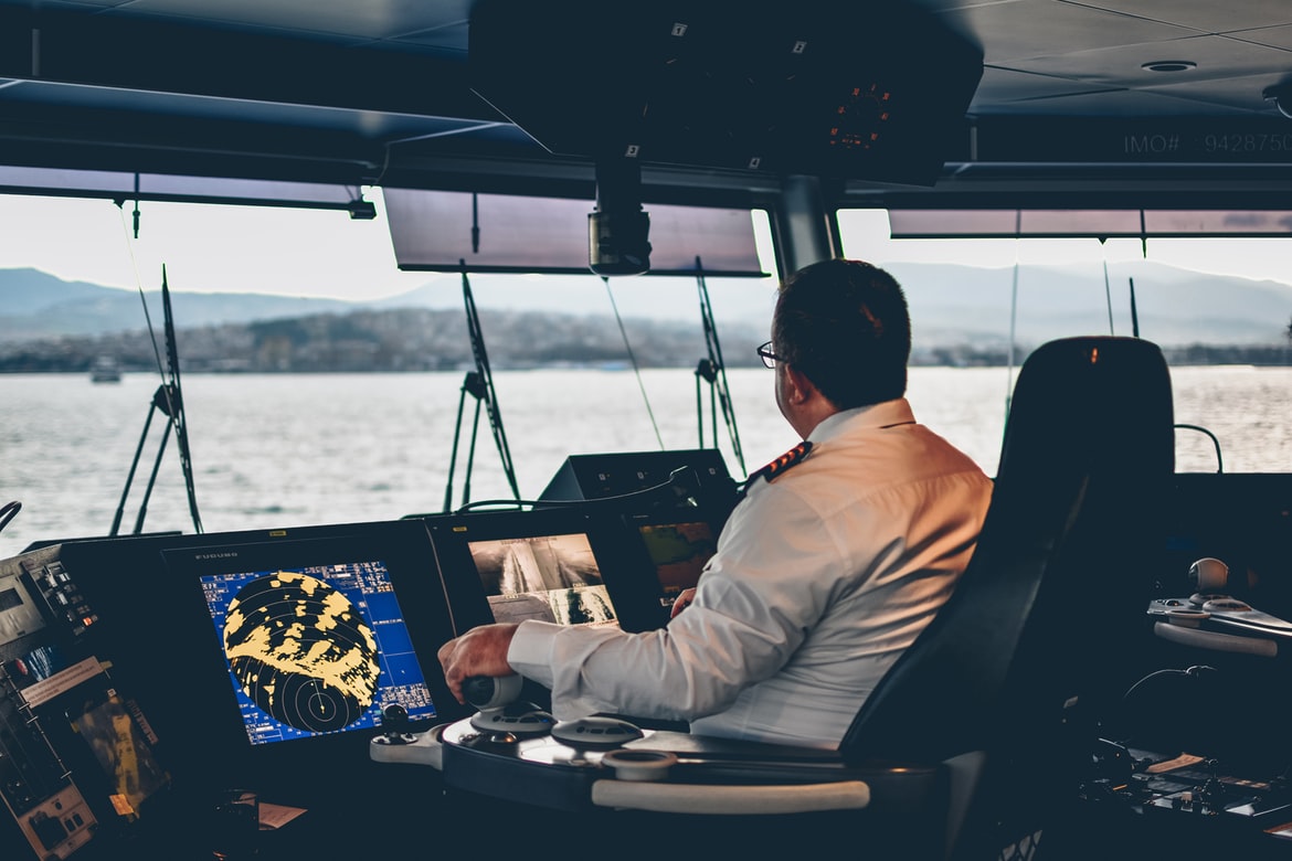
General overview of the ship navigational and communicatoin equipment
From the ancient times navigators have been used different visual references and rely mainly on stars in the sky for navigating and laying out a course. Since that time ships’ design has been improved greatly as well as the navigational equipment used on board.
Today we can see a lot of electronic devices and advanced bridge equipment on board facilitating ship officers to easily define numbers of parameters such as ship’s course, velocity, detect other objects nearby etc.
Nowadays each vessel must have different navigational and communication equipment that should guarantee safe navigation. All this equipment must be checked and tested regularly as defined in SOLAS Convention, Chapter V. The exact list of navigational equipment depends on the tonnage of the vessel, the sailing range and date of building.
In this article you will find general navigational and communication equipment used on board of a modern ship.
SEARCH FOR: radio, navigational and communication equipment suppliers and service providers
CONTENT:
1.Radar
2.ECDIS
3.ARPA
4.Autopilot
5.ATA
6.AIS
7.Magnetic compass
8.Gyrocompass
9.Rudder angle indicator
10.Speed and distance log device
11.GMDSS
12.VDR
13.Echo sounder
14.ROTI
15.LRIT
16.BNWAS
17.SART
18.NAVTEX
19.VSAT
20.GPS
21.VHF radio
22.UHF radio
23.Sound reception system
24.Ship’s bell
25.Ship’s gong
26.Ship’s whiste
27.Anemometer
28.ALDIS lamp
29.Navigation lights
30.Maritime signal flags
31.Sextant
Different types of navigational and communication equipment used onboard a ship. General overview.
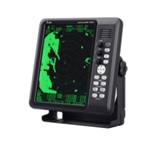
1. Radar
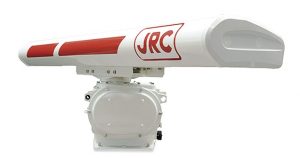
Radar is a rotating antenna sounding the surrounding area of a ship. With the help of this radar any targets like other ships or rocks can be detected. It defines the distance to such obstacles helping to avoid collisions. There are two types of radars used on ships, depending on frequency they operate at: X-band radar (10 GHz with 3 cm wavelength) and S-band radar (3 GHz with 10 cm wavelength). X-band radar provides more resolutions of the detected targets due to higher frequency. While S-band provides more accurate data during adverse weather like heavy rain as it is more resistant to interference.
Radar. Picture: https://www.jrc.co.jp/
2. ECDIS
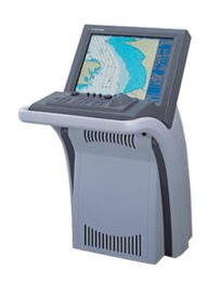
ECDIS stands for Electronic Chart Display and Information System. This is an electronic navigation system offering digital charts and navigational information as an alternative to paper charts. With the use of the ECDIS it has become much easier to pinpoint locations and attain directions for ship’s navigators. The ECDIS utilizes the feature of the GPS (Global Positioning System) to effectively pinpoint the navigational point.
Electronic chart display and information system. Picture: https://omegasolutions.ru/
3. ARPA
Automatic Radar Plotting Aid was created to use on ships in order to improve the standard of collision avoidance at sea. ARPA is able to automatically acquire and constantly monitor targets. The system monitors their courses and speed and calculate their closest points of approach to own ship in order plot safe passage with other ships.
Automatic radar plotting aid. Picture: https://www.nauticexpo.com/
4. Autopilot
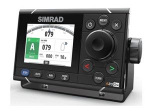
Autopilot is one of the most technically complicated navigational equipment used on modern ships. System automatically controls the steering mechanism of a ship and maintains it on a set course. Autopilot is synchronized with the gyrocompass. Thus any malfunction with gyrocompass will result in lost of ability to control the vessel in automatic mode. Autopilot can also be synchronized with ECDIS which allows them to follow the course laid out on the digital chart.
Autopilot. Picture: https://www.navico-commercial.com/
5. ATA
Automatic Tracking Aid displays information about the tracked targets in graphical and numerical form. It uses radar contacts that allows the navigator to plan a safer course in order to avoid collision with other ships.
Automatic tracking aid. Picture: https://cirspb.ru/
6. AIS
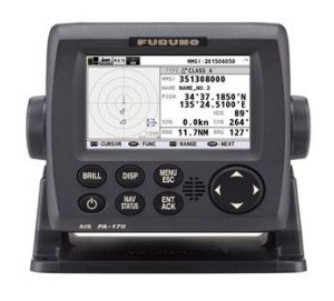
Automatic Identification System is an automatic tracking system. It serves to identify such information about ships like position, course, speed, dimensions and other safety related data. The information is displayed on the AIS station or ECDIS. The main purpose of AIS is safety of navigation and avoidance of collisions. AIS system must always be kept in operational mode.
Automatic identification system. Picture: https://www.navico-commercial.com/
7. Magnetic compass
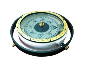
Magnetic Compass has been used by seafarers to navigate more accurate and safely. Magnetic compass is one of the oldest navigational instrument. It determines direction on the surface of Earth relative to its poles by means of a magnetic pointer. This magnetized pointer of a compass is marked on the North.
Magnetic compass. Picture: https://www.radioholland.com/
8. Gyrocompass
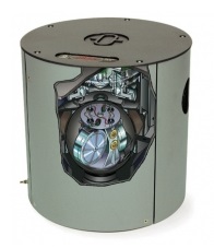
Gyrocompass is a navigational instrument where a continuously driven gyroscope is used to seek the true North direction along the surface of the Earth with high accuracy. It operates by seeking an equilibrium direction under the combined effects of the force of gravity and the daily rotation of Earth. A gyroscope consists of a spinning wheel (rotor) contained within gimbals which permit movement about three mutually perpendicular axes: the horizontal axis, the vertical axis and the spin axis.
Gyro compass. Picture: https://www.aagehempel.com/
9. Rudder angle indicator
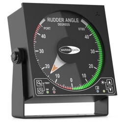
Rudder Angle Indicator (RAI) serves to remotely identify position of the ship’s rudder blade. The device is usually located in the wheelhouse, bridge wings and engine room. RAI works in conjunction with a rudder angle transmitter.
Rudder angle indicator. Picture: https://marine-data.co.uk/
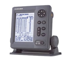
10. Speed and distance log device
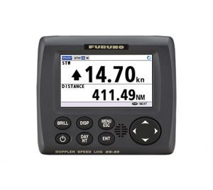
Speed and Distance Log Device (speed log, or Doppler log) is an electronic instrument which measures a vessel’s surface velocity. The speed is determined with reference to water flowing by the hull (water reference speed) or to the seabed (ground reference speed) which is required by SOLAS and depends on size of a ship. Despite the presence of a GPS on board that defines course and speed of a ship over ground, the speed log is still indispensable device.
Speed and distance log device. Picture: https://www.furuno.com/
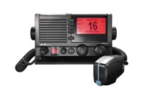
11. GMDSS
Global Maritime Distress and Safety System is a worldwide system for automated emergency signal communication for ships at sea. The goal of GMDSS is to guarantee that complying vessels will be able to communicate with an onshore station at any time, from any location, in case of distress or to exchange safety-related information. GMDSS consists of several systems which are intended to perform different functions like transmission of ship-to-shore distress alerts, reception of shore-to-ship distress alerts, transmission and reception of ship-to-ship distress alerts, of search and rescue co-ordinating communications, of maritime safety information and others. INMARSAT, NAVTEX, EPIRB, SART, Digital Selective Calling (DSC) are parts of GMDSS.
Global maritime distress and safety system. Picture: https://furuno.ru/
12. VDR
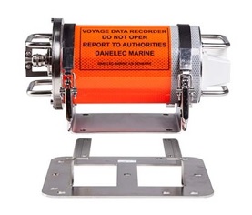
Voyage Data Recorder is a data recording system designed to collect data from various sensors on board a ship. VDR is a kind of black box carried on aircrafts. The data collected is stored in an externally mounted protective storage box. In case of any accident the data can be retrieved and used by the investigator to review and analyze the collected information in order to understand the cause of the accident.
Voyage data recorder. Picture: https://www.danelec-marine.com/
13. Echo sounder
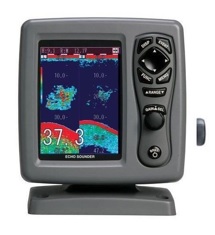
Echo Sounder is a type of Sound Navigation and Ranging (SONAR) device used to determine the depth of water below the bottom of a ship by transmitting sound waves into water. A sound pulse bounces off a reflective layer and returned as an echo to the sound wave source.
Echo sounder. Picture: https://www.indiamart.com/
14. ROTI
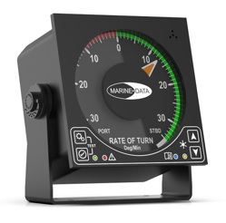
Rate Of Turn Indicator indicates the instantaneous rate a ship is turning. It is one of the most important instruments a helmsman can have when steering a course. It is fitted on ship as an independent device integrated with the steering gear / auto pilot.
Rate of turn indicator. Picture: https://marine-data.co.uk/
15. LRIT
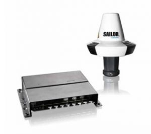
The Long-Range Identification and Tracking system was established for the global identification and tracking of ships to enhance security of shipping and protect safety and marine environment. By using vessel information and position data from ships registered to IMO member states that are subject to SOLAS, the system allows the essential sharing of maritime security information between contracting governments.
Long-range identification and tracking system. Picture: https://www.cobhamsatcom.com/
16. BNWAS
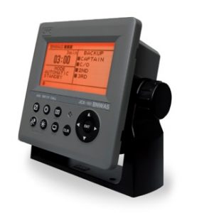
Bridge Navigational Watch Alarm System is mandatory for all ships with more than 150 GT. BNWAS monitors the watch officer’s presence through watch safety system functions. The purpose of the system is to monitor bridge activity and avoid possible accidents by detecting officer’s of the watch disability. At a certain intervals a watch officer must press the button on a Timer Reset Panel (or to operate navigation equipment like ECDIS). In case watch officer fails to press the button, audible and visual alarms will be generated in the wheelhouse. Then if the watch officer still doesn’t react to the alarm, the system will transfer the alarm to the Cabin Panels in order to inform another officers of the watch officer’s disability.
Bridge navigational watch alarm system. Picture: http://www.jrc.co.jp/
17. SART

Search And Rescue Radar Transponder is the main component of the GMDSS. This is an active device transmitting signal to other ships. By means of signal from SART other vessels can locate ship in distress. SART attract the attention of passing vessels by indicating the location of the ship in distress on their radar screen.
Search and rescue radar transponder. Picture: https://jotron.com/
18. NAVTEX
Navigational telex is the primary mean for transmitting coastal urgent marine safety information to ships including navigational, meteorological or other urgent information. The device is an important part of GMDSS. NAVTEX provides navigators with a forecast for wind, sea, precipitations, visibility and other warnings and forecasts that can affect safety navigation. The information is received by NAVTEX in automatic mode and printed directly by telex.
Navigational telex. Pictures: https://furuno.ru/
19. VSAT
Very Small Aperture Terminal is a small telecommunication earth station that receives and transmits real time data via satellites. Terminal transmits signals to orbital satellites which are then transmitted to different hubs around the world. With the implementation of VSAT technology on board a ship crew can now use high speed steady internet connection corresponding to up-to-date communication standards.
Very small aperture terminal. Picture: https://www.marsat.ru/
20. GPS
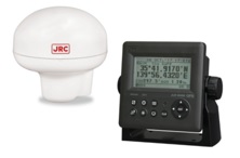
Global Positioning System is a satellite navigation system that allows to determine location of the objects with high precision. GPS was initially created for military purposes. Nowadays it is used widely in our daily life. By means of GPS ship’s position, ship’s speed, course and time can be determined and utilized to define distance between two marked objects. The information received by GPS is usually duplicated on other bridge equipment like radar and ECDIS.
Global positioning system. Picture: http://www.jrc.co.jp/
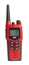
21. VHF radio
Marine Very High Frequency radio is the two-way communicator used to transfer and receive messages. Marine VHF radios operate between 156 and 174 MHz. Equipment for this radio system is installed on all big ships and can be portable and non-portable. A VHF radio is reliable and used for many safety purposes including search and rescue, maintaining communication between different ships and between ship and shore based station. Channel 16 is the common channel that all ships equipped with a VHF radio are required to monitor. A marine VHF radio is very helpful when it comes to sending distress signals across the channels to other ships or coast guard. Also VHF radio can be used for making calls through a marine operator.
Very high frequency radio. Picture: https://www.cobhamsatcom.com/
22. UHF radio
Marine Ultra High Frequency radio uses frequencies from 300 MHz to 3 GHz range for voice communications. A UHF radio make possible a real-time communication between two or more radios on board a ship even crew members are located in different parts of the ship. One of the most important feature of the UHF frequencies is the better propagation inside metal structures. Thus these walkie-talkie radios are now very popular. A UHF radios are widely used by fire parties on board a ships. Using the fire-fighter radio on the same frequency as the daily on board UHF frequencies will provide the possibility of establishing communication between existing radios for on board communication and the fire-fighter radio.
Ultra high frequency radio. Picture: https://www.polaris-as.dk/
23. Sound reception system

Sound Reception System is the electronic acoustical navigational aid that enables the ship’s crew to hear outside sound signals at enclosed spaces. Signals with audio frequency 70 Hz – 80 Hz are received by the system and transmitted inside the wheelhouse.
Sound reception system. Picture: https://unicont.com/
24. Ship’s bell

“Ring the bell!” It’s unlikely to hear such a command on board of the advanced tanker or gas carrier. But the ship’s bell (or forecastle bell) is a strong maritime symbol and it can still be found on the modern ships. The COLREG says that any ship must have on board a bell for ships of over 12 meters in length. The real ship’s bell is made of bronze, but it is often made of brass. Traditionally it was used to ring a quarter and warn other ships during limited visibility, or in case of danger like fire. Nowdays the signal is given automatically through the ship’s horn.
Ship’s bell. Picture: https://www.chmarine.com/
25. Ship’s gong

The COLREG prescribes that vessels 100 meters or more in length should carry a gong in addition to ship’s bell and whistle (Section III, Part D, Rule 33). In a ship at anchor after the ringing of the bell in the forepart of the ship the ship’s gong should be sounded rapidly for about 5 seconds in the aft part of the ship. Like with the ship’s bell the signal is nowadays given automatically trough electronic sounding system.
Ship’s gong. Picturehttp://poseidontr.net/
26. Ship’s whistle
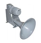
A ship’s whistle (or horn) is an electric sound signaling appliance that is used for giving maneuvering and warning signals and signals in restricted visibility. According to COLREG (Annex III) different ships, depending on their length, must have whistle with particular technical specifications: positioning, frequencies, range of audibility, signal intensity etc.
Ship’s whistle (horn). Picture: https://www.kahlenberg.com/
27. Anemometer
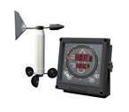
Anemometer (or anemoscope) is a digital measuring instrument installed on ship to indicate wind direction and velocity at sea for the purpose of navigation. Besides the wind measurement the anemometer can measure pressure, temperature and other ambient weather parameters.
Anemometer. Picture: http://www.hiseamarine.com/
28. ALDIS lamp

ALDIS lamp (or Daylight Signaling Lamp) is a visual signaling device for optical communication. It was named after Arthur Aldis who invented a widely used design of the lamp. Modern signal lamps are a focused lamp which can produce a pulse of light typically using Morse code. Signaling lamps are not the main communication outfits on board of a modern ships, though they are still used as a backup device in case of failure of another means of radio communication.
Daylight signaling lamp. Picture: https://www.datema.nl/
29. Navigation lights

Navigation lights are colored electric lights fixed on the ship’s masts. They are used for safety navigation purpose in order to prevent collision at nighttime and during poor visibility. Navigation lights indicate size of the ship, the direction the ship is proceeding, the angle you see the ship, the ship’s condition (underway or at anchorage).
Navigation lights. Picture: https://glamox.com/
30. Maritime signal flags
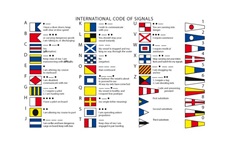
Maritime signal flags are international signs or signals used on ships to provide ways of communication. Maritime signal flags are used to visually transmit safety navigation related information. Being an international code system they can be used for communication between ships or between ship and shore. Each individual flag has its own specific meaning. Flags can be used in combination with other flags. Maritime signal flags are made of 26 square flags representing the letters of the alphabet, 10 numbered pendants, one answering pendant and three substitutes. All flags have only five colors that make it simple to recognize them. Like ALDIS lamp, the maritime signal flags can substitute modern communication equipment during its breakdown.
Maritime signal flags. Picture: https://rockymountainflag.com/
31. Sexstant
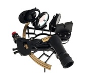
Sextant is an instrument used to measure angles. Sextant has been used for many years for celestial navigation measuring the angle between the horizon and a celestial body such as the Moon, the Sun or a star in order to determine latitude and longitude. This tool has been known since the beginning of 18th century. But even today all navigators should be acquainted with the principles of its work and use it in case when other navigational equipment is out-of-work.
Sextant. Picture: https://www.celestaire.com/
Useful links: